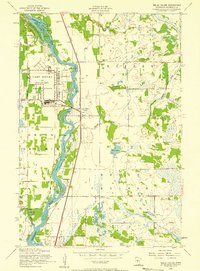
1956 Map of Belle Prairie
USGS Topo · Published 1958About this map
The Camp Ripley Military Reservation dominates the western bank of the river in this mid-century survey, featuring a prominent Airfield and a network of training grounds. The Mississippi River serves as the central geographic spine, its channel crowded with a series of named landforms including Topeka Islands, Ducette Island, and Roscoe Island. This reach of the river is defined by a dense cluster of river-islands and the winding path of Fletcher Creek as it feeds into the main waterway from the east.
Find a feature on this map
46 named features on this map. Tap any name to fly to it.
Don’t see what you’re looking for? This feature index may not catch every label — zoom into the map to look around manually.
Map Details
Editions of this 1956 Belle Prairie Map
2 editions found
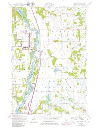
Other maps of this area

1948 · Belle Prairie
USGS Topo · 1:62,500

1948 · Pierz
USGS Topo · 1:62,500

1948 · Lastrup
USGS Topo · 1:62,500

1948 · Little Falls
USGS Topo · 1:62,500

1950 · Lastrup
USGS Topo · 1:62,500

1950 · Belle Prairie
USGS Topo · 1:62,500

1950 · Little Falls
USGS Topo · 1:62,500

1950 · Pierz
USGS Topo · 1:62,500

1953 · Brainerd
USGS Topo · 1:250,000

1953 · Saint Cloud
USGS Topo · 1:250,000