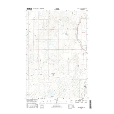
2016 Map of Belle Prairie NW
USGS Topo · Published 2016About this map
The Mississippi River carves the eastern boundary of this landscape, winding past Pipe Island and the expansive wetlands of Hole in Day Marsh. This section of central Minnesota is defined by its glacial hydrology, with a dense network of water bodies including Coon Stump Lake, Frog Lake, and Lake Alexander. For those interested in local heritage and smaller-scale landmarks, the map records the Stroming Grave Site and the poignant Lightner Baby Grave located west of the river. A complex system of named roads and trails, such as Kodiak Rd, Normandy Rd, and Gettysburg Rd, provides access through the marshy terrain and past archaeological sites like the Camp Ripley Mounds. From the oxbows of Broken Bow to the scattered waters of Three Finger Lake, the map documents a territory where managed land use and natural waterways intersect.
Find a feature on this map
78 named features on this map. Tap any name to fly to it.
Don’t see what you’re looking for? This feature index may not catch every label — zoom into the map to look around manually.
Map Details
Editions of this 2016 Belle Prairie NW Map
This is the sole edition of this map. No revisions or reprints were ever made.
Other maps of this area

1916 · Pillager
USGS Topo · 1:62,500

1919 · Pillager
USGS Topo · 1:62,500

1948 · Belle Prairie
USGS Topo · 1:62,500

1948 · Cushing
USGS Topo · 1:62,500

1950 · Belle Prairie
USGS Topo · 1:62,500

1950 · Cushing
USGS Topo · 1:62,500

1953 · Brainerd
USGS Topo · 1:250,000

1954 · Baxter
USGS Topo · 1:24,000

1954 · Pillager
USGS Topo · 1:24,000
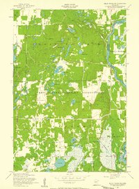
1956 · Belle Prairie NW
USGS Topo · 1:24,000