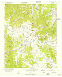
1955 Map of Belleview
USGS Topo · Published 1956About this map
The Harpeth River carves a series of dramatic loops through this mid-century Tennessee landscape, defining the rural character of the area before suburban expansion. The community of Bellevue serves as a central hub, situated where the St Louis and Chattanooga RR and several major thoroughfares like Harding Road converge. The topography is marked by significant bends in the river, including Hicks Bend and Sawyer Bend, which historically influenced local land use and transportation routes.
Find a feature on this map
54 named features on this map. Tap any name to fly to it.
Don’t see what you’re looking for? This feature index may not catch every label — zoom into the map to look around manually.
Map Details
Editions of this 1955 Belleview Map
2 editions found
Other maps of this area

1901 · Colombia
USGS Topo · 1:125,000

1903 · Nashville
USGS Topo · 1:125,000

1909 · Franklin
USGS Topo · 1:62,500

1930 · White Bluff
USGS Topo · 1:62,500

1932 · Nashville
USGS Topo · 1:62,500

1933 · White Bluff
USGS Topo · 1:62,500

1946 · Leipers Fork
USGS Topo · 1:24,000

1949 · Leipers Fork
USGS Topo · 1:24,000

1949 · Franklin
USGS Topo · 1:24,000

1951 · Fairview
USGS Topo · 1:24,000