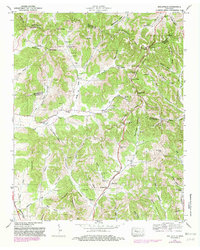
1949 Map of Belleville
USGS Topo · Published 1982About this map
Elk Ridge and Richmond Ridge dominate this section of Middle Tennessee, where the borders of Bedford, Lincoln, Marshall, and Moore Counties converge. The landscape is defined by deep hollows and high gaps, such as Hannah Gap and Stamp Gap, which shaped the early paths of local commerce and settlement. Small rural communities like Bledsoe and Belleville serve as anchors in a region where family lineage is preserved through numerous burial sites, including the Sorrells Cem, McAdam Cem, and Gibson Cem.
Find a feature on this map
77 named features on this map. Tap any name to fly to it.
Don’t see what you’re looking for? This feature index may not catch every label — zoom into the map to look around manually.
Map Details
Editions of this 1949 Belleville Map
2 editions found
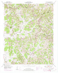
Other maps of this area

1936 · Booneville
USGS Topo · 1:24,000

1936 · Shelbyville
USGS Topo · 1:24,000

1936 · Belfast
USGS Topo · 1:24,000

1936 · Belleville
USGS Topo · 1:24,000

1936 · Boonshill
USGS Topo · 1:24,000

1936 · Petersburg
USGS Topo · 1:24,000

1936 · Bedford
USGS Topo · 1:24,000

1936 · Mulberry
USGS Topo · 1:24,000

1936 · Fayetteville
USGS Topo · 1:24,000

1944 · Shelbyville
USGS Topo · 1:100,000