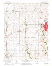
1966 Map of Belleville
USGS Topo · Published 1967About this map
Belleville serves as the focal point of this mid-1960s Kansas survey, exhibiting a dense network of civic and community infrastructure including the West Sch, East Sch, and High Sch. The town is positioned along the Chicago Rock Island and Pacific railroad, which cuts west toward the small settlement of Rydal. Beyond the urban core, the landscape is defined by the rural townships of Union, Freedom, Scandia, and Belleville. Numerous family and community burial grounds, such as Union Valley Cem and Poplar Grove Cem, are scattered across the terrain, providing essential landmarks for genealogical research. The presence of a Drive-in Theater and the Belleville Airport reflects the mid-century development patterns of Republic County, while various Sandpits indicate the local extractive industry that supported the region's road and rail networks.
Find a feature on this map
30 named features on this map. Tap any name to fly to it.
Don’t see what you’re looking for? This feature index may not catch every label — zoom into the map to look around manually.
Map Details
Editions of this 1966 Belleville Map
This is the sole edition of this map. No revisions or reprints were ever made.
Other maps of this area

1892 · Concordia
USGS Topo · 1:125,000

1955 · Manhattan
USGS Topo · 1:250,000

1956 · Manhattan
USGS Topo · 1:250,000

1957 · Manhattan
USGS Topo · 1:250,000

1965 · Wayne
USGS Topo · 1:24,000

1965 · Concordia NW
USGS Topo · 1:24,000

1965 · Kackley
USGS Topo · 1:24,000

1966 · Scandia
USGS Topo · 1:24,000
1966 · Belleville SE
USGS Topo · 1:24,000
1968 · Munden
USGS Topo · 1:24,000