
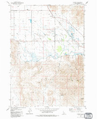
1957 Map of Bellevue
USGS Topo · Published 1973About this map
Bellevue and the historic mining district of Broadford anchor this mid-century Idaho landscape, where the Big Wood River valley meets the high ridges of the Sawtooth National Forest. The map documents a complex industrial history through numerous named claims, including the Minnie Moore, Silver Star Queen, and Liberty Gem Mine, alongside the Apache Mill.
Find a feature on this map
130 named features on this map. Tap any name to fly to it.
Don’t see what you’re looking for? This feature index may not catch every label — zoom into the map to look around manually.
Map Details
Editions of this 1957 Bellevue Map
This is the sole edition of this map. No revisions or reprints were ever made.
Other maps of this area

1895 · Hailey
USGS Topo · 1:125,000

1897 · Hailey
USGS Topo · 1:125,000

1955 · Hailey
USGS Topo · 1:250,000

1957 · Bellevue
USGS Topo · 1:62,500

1959 · Hailey
USGS Topo · 1:250,000

1962 · Hailey
USGS Topo · 1:250,000

1967 · Baugh Creek SW
USGS Topo · 1:24,000

1967 · Mahoney Butte
USGS Topo · 1:24,000

1967 · Hailey
USGS Topo · 1:24,000
1979 · Gannett
USGS Topo · 1:24,000