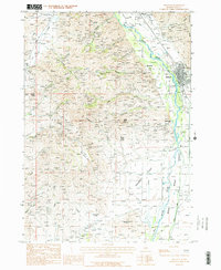
1986 Map of Bellevue
USGS Topo · Published 1986About this map
Bellevue serves as the focal point of this mid-1980s landscape, situated along the Big Wood River at the edge of Poverty Flat. The map reveals a legacy of silver and lead mining in the Wood River Valley, with numerous industrial landmarks including the Minnie Moore Mine Shaft and the Star Mine Shaft west of the river. The small settlement of Broadford marks an earlier center of activity near these mines, while the surrounding terrain is defined by a series of steep drainages such as Colorado Gulch and Minnie Moore Gulch. Agricultural development is evident in the valley floor through irrigation works like the Hiawatha Canal and Cove Canal. The contrast between the level plains of Sky Ranch Flat and the rising peaks of Gilman Butte illustrates the transition from the river valley to the mountain foothills.
Find a feature on this map
42 named features on this map. Tap any name to fly to it.
Don’t see what you’re looking for? This feature index may not catch every label — zoom into the map to look around manually.
Map Details
Editions of this 1986 Bellevue Map
2 editions found
Other maps of this area

1895 · Hailey
USGS Topo · 1:125,000

1897 · Hailey
USGS Topo · 1:125,000

1955 · Hailey
USGS Topo · 1:250,000

1957 · Bellevue
USGS Topo · 1:62,500

1957 · Bellevue
USGS Topo · 1:24,000

1959 · Hailey
USGS Topo · 1:250,000

1962 · Hailey
USGS Topo · 1:250,000

1967 · Baugh Creek SW
USGS Topo · 1:24,000

1967 · Mahoney Butte
USGS Topo · 1:24,000

1967 · Hailey
USGS Topo · 1:24,000