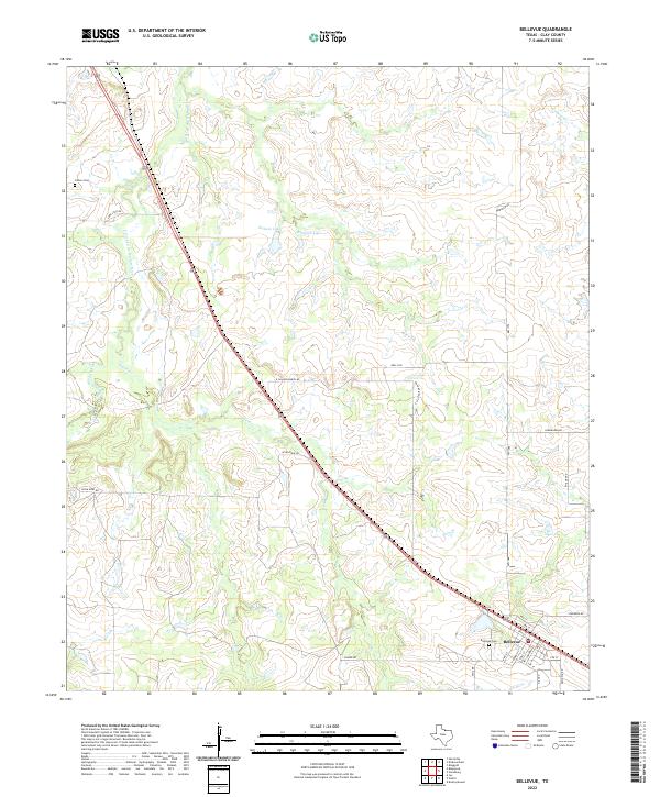
2022 Map of Bellevue
USGS Topo · Published 2022About this map
Bellevue and its surrounding Clay County ranchlands are documented here as they appeared in 2022. The town sits at the intersection of several local routes, with its grid defined by streets like 2nd St and King St. For genealogists and local historians, the map identifies significant burial sites including Bellevue Cem on the edge of town and the more isolated Cullers Cem to the northwest. The drainage patterns of the north Texas plains are clearly visible, dominated by the Little Wichita River and the E Fork Little Wichita River. Numerous family-named roads, such as E Scaling Ranch Rd and Wynn Gray Rd, crisscross the landscape between smaller water features like Dickson Lake, Hapgood Lake, and Smith Cr.
Find a feature on this map
31 named features on this map. Tap any name to fly to it.
Don’t see what you’re looking for? This feature index may not catch every label — zoom into the map to look around manually.
Map Details
Editions of this 2022 Bellevue Map
This is the sole edition of this map. No revisions or reprints were ever made.
Other maps of this area

1905 · Montague
USGS Topo · 1:125,000

1954 · Sherman
USGS Topo · 1:250,000

1954 · Wichita Falls
USGS Topo · 1:250,000

1956 · Henrietta
USGS Topo · 1:62,500

1958 · Wichita Falls
USGS Topo · 1:250,000

1958 · Sherman
USGS Topo · 1:250,000

1961 · Stoneburg
USGS Topo · 1:24,000

1961 · Brushy Mound
USGS Topo · 1:24,000
1963 · Vashti
USGS Topo · 1:24,000
1964 · Joy
USGS Topo · 1:24,000