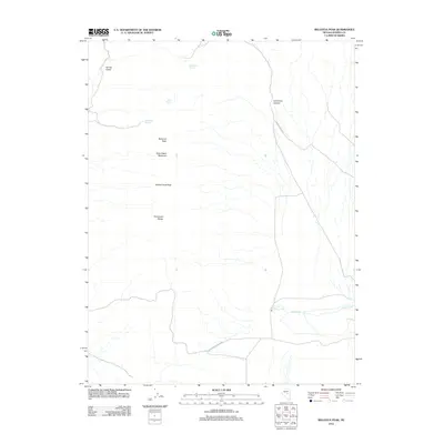
2012 Map of Bellevue Peak
USGS Topo · Published 2012About this map
Bellevue Peak and White Cloud Peak anchor this high-elevation landscape in the heart of the Fish Creek Range. This 2012 survey reveals a classic Great Basin environment defined by its water sources, where named springs provide critical points of reference in an otherwise arid expanse. Small-scale human activity is traced through routes like the Fish Creek-Ardan Rnch road and McCullough Sprs, connecting the more level ground of Spring Valley to the steep relief of Lamoreux Canyon. The map records several family-named features, such as Dave Keane Mountain and Marteletti Spring, which reflect the ranching and prospecting history of Eureka County. For genealogists and historians, these specific place names offer a record of land use and occupancy in this sparsely populated interior of Nevada.
Find a feature on this map
13 named features on this map. Tap any name to fly to it.
Don’t see what you’re looking for? This feature index may not catch every label — zoom into the map to look around manually.
Map Details
Editions of this 2012 Bellevue Peak Map
This is the sole edition of this map. No revisions or reprints were ever made.
Other maps of this area

1926 · Roberts Mountains
USGS Topo · 1:250,000

1929 · Roberts Mountains
USGS Topo · 1:250,000

1953 · Pinto Summit
USGS Topo · 1:62,500

1955 · Millett
USGS Topo · 1:250,000

1956 · Bellevue Peak
USGS Topo · 1:62,500

1956 · Cockalorum Wash
USGS Topo · 1:62,500

1956 · Ely
USGS Topo · 1:250,000

1959 · Ely
USGS Topo · 1:250,000

1959 · Millett
USGS Topo · 1:250,000

1963 · Ely
USGS Topo · 1:250,000