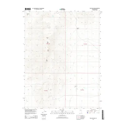
2014 Map of Bellevue Peak
USGS Topo · Published 2014About this map
Fenstermaker Grave provides a solitary human focal point in this high-elevation landscape within the Fish Creek Range of Nevada. The terrain is defined by a succession of high points, including Bellevue Peak, White Cloud Peak, and Dave Keane Mtn, which overlook a network of canyons and hills. The availability of water in this arid environment is clearly mapped through several vital sources, such as Dave Keane Spring, Martelett Spring, and the lower-lying Fish Creek Springs near the banks of Fish Cr. The relationship between these springs and the adjacent peaks suggests a landscape where movement was dictated by the topography of the Mahogany Hills and the seasonal flow of high-desert water. The map's layout, split across several townships including t17n r52e and t16n r53e, captures the intricate relief of Lamoreux Canyon and the surrounding high country.
Find a feature on this map
16 named features on this map. Tap any name to fly to it.
Don’t see what you’re looking for? This feature index may not catch every label — zoom into the map to look around manually.
Map Details
Editions of this 2014 Bellevue Peak Map
This is the sole edition of this map. No revisions or reprints were ever made.
Other maps of this area

1926 · Roberts Mountains
USGS Topo · 1:250,000

1929 · Roberts Mountains
USGS Topo · 1:250,000

1953 · Pinto Summit
USGS Topo · 1:62,500

1955 · Millett
USGS Topo · 1:250,000

1956 · Bellevue Peak
USGS Topo · 1:62,500

1956 · Cockalorum Wash
USGS Topo · 1:62,500

1956 · Ely
USGS Topo · 1:250,000

1959 · Ely
USGS Topo · 1:250,000

1959 · Millett
USGS Topo · 1:250,000

1963 · Ely
USGS Topo · 1:250,000