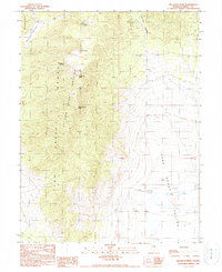
1990 Map of Bellevue Peak
USGS Topo · Published 1990About this map
The Dave Keane Mountain Range dominates this portion of Eureka County, rising between the expansive Spring Valley to the west and Fish Creek Valley to the east. Surveyed in the late 1980s, the landscape is defined by its high desert hydrology and prospecting history. High points like Bellevue Peak and White Cloud Peak overlook a terrain marked by numerous unnamed prospect sites and prospects, signaling the region's enduring mining interest.
Find a feature on this map
20 named features on this map. Tap any name to fly to it.
Don’t see what you’re looking for? This feature index may not catch every label — zoom into the map to look around manually.
Map Details
Editions of this 1990 Bellevue Peak Map
This is the sole edition of this map. No revisions or reprints were ever made.
Other maps of this area

1926 · Roberts Mountains
USGS Topo · 1:250,000

1929 · Roberts Mountains
USGS Topo · 1:250,000

1953 · Pinto Summit
USGS Topo · 1:62,500

1955 · Millett
USGS Topo · 1:250,000

1956 · Bellevue Peak
USGS Topo · 1:62,500

1956 · Cockalorum Wash
USGS Topo · 1:62,500

1956 · Ely
USGS Topo · 1:250,000

1959 · Ely
USGS Topo · 1:250,000

1959 · Millett
USGS Topo · 1:250,000

1963 · Ely
USGS Topo · 1:250,000