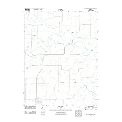
2012 Map of Bellflower North
USGS Topo · Published 2012About this map
Bellflower and the small settlement of Gamma anchor this rural landscape in Montgomery County, where the topography is defined by the winding West Fork Cuivre River and its numerous tributaries. Family and community heritage is deeply rooted here, evidenced by a high concentration of burial grounds including Macedonia Cemetery, Mabry Cemetery, Pontlow Cemetery, and Berger Cemetery. The terrain transitions from the elevated ridge known as the Backbone down through Fulcher Hollow, revealing a landscape shaped by water and wood. For researchers of local history, the map preserves the location of Stillhouse Ford on the river and provides a look at the rural road network that historically linked these isolated farms and homesteads, with named routes like Coal Mine Rd and Lincoln School Rd hinting at the area's former industrial and educational landmarks.
Find a feature on this map
64 named features on this map. Tap any name to fly to it.
Don’t see what you’re looking for? This feature index may not catch every label — zoom into the map to look around manually.
Map Details
Editions of this 2012 Bellflower North Map
This is the sole edition of this map. No revisions or reprints were ever made.
Other maps of this area

1890 · Louisiana
USGS Topo · 1:125,000

1890 · Hermann
USGS Topo · 1:125,000

1937 · Silex
USGS Topo · 1:62,500

1939 · Silex
USGS Topo · 1:48,000

1942 · New Florence
USGS Topo · 1:62,500

1942 · Bellflower
USGS Topo · 1:62,500

1943 · Warrenton
USGS Topo · 1:62,500

1945 · Bellflower
USGS Topo · 1:62,500

1945 · Warrenton
USGS Topo · 1:62,500

1946 · New Florence
USGS Topo · 1:62,500