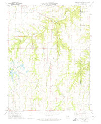
1973 Map of Bellflower South
USGS Topo · Published 1975About this map
Bellflower and the small settlement of High Hill anchor this 1970s survey of eastern Missouri, where the landscape is defined by the winding paths of Bear Creek and its many tributaries. The Burlington Northern railroad cuts a diagonal path through the northern section, passing by the Baptist Cem of Bellflower as it connects these rural communities. To the south, the terrain becomes more varied with the presence of Golden Eagle Lake and Heron Lake, alongside the Ranch Roy-L Landing Strip.
Find a feature on this map
23 named features on this map. Tap any name to fly to it.
Don’t see what you’re looking for? This feature index may not catch every label — zoom into the map to look around manually.
Map Details
Editions of this 1973 Bellflower South Map
This is the sole edition of this map. No revisions or reprints were ever made.
Other maps of this area

1890 · Louisiana
USGS Topo · 1:125,000

1890 · Hermann
USGS Topo · 1:125,000

1937 · Silex
USGS Topo · 1:62,500

1939 · Silex
USGS Topo · 1:48,000

1942 · New Florence
USGS Topo · 1:62,500

1942 · Bellflower
USGS Topo · 1:62,500

1943 · Warrenton
USGS Topo · 1:62,500

1945 · Bellflower
USGS Topo · 1:62,500

1945 · Warrenton
USGS Topo · 1:62,500

1946 · New Florence
USGS Topo · 1:62,500