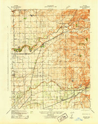
1942 Map of Bellota
USGS Topo · Published 1942About this map
Campo De Los Franceses land grants and the agricultural valleys of the Mokelumne River and Calaveras River dominate this 1942 landscape. The map reveals an intensive network of rural education, featuring numerous one-room schoolhouses like Tokay Colony Sch, Bruella Sch, and Alpine Sch that served the local farming communities. Transportation is a defining characteristic, with the Central California Traction line and the Southern Pacific railroad cutting through the central valley, connecting the town of Linden and the settlement of Lockeford. To the east, the terrain transitions into the foothills of the Sierra, where the Stockton Terminal & Eastern line terminates. Genealogists will find interest in the Mokelumne Beach Cem and the distinct small-town layouts of Bellota and Clements during the early war years.
Find a feature on this map
44 named features on this map. Tap any name to fly to it.
Don’t see what you’re looking for? This feature index may not catch every label — zoom into the map to look around manually.
Map Details
Editions of this 1942 Bellota Map
This is the sole edition of this map. No revisions or reprints were ever made.
Other maps of this area

1889 · Jackson
USGS Topo · 1:125,000

1892 · Jackson
USGS Topo · 1:125,000

1894 · Lodi
USGS Topo · 1:125,000

1897 · Jackson
USGS Topo · 1:125,000

1902 · Jackson
USGS Topo · 1:125,000

1908 · Waterloo
USGS Topo · 1:31,680

1908 · Linden
USGS Topo · 1:31,680

1908 · Lockeford
USGS Topo · 1:31,680

1909 · Clay
USGS Topo · 1:31,680

1909 · Goose Creek
USGS Topo · 1:31,680