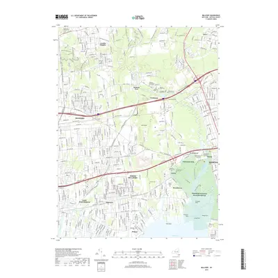
2019 Map of Bellport
USGS Topo · Published 2019About this map
The southern coast of Long Island meets Bellport Bay in this detailed survey of the Brookhaven area. Coastal topography is defined by the Carmans River corridor and the expansive Wertheim NWR, which preserves the wetlands of Fireplace Neck and Straddle Point. Inland, the landscape reflects the dense settlement patterns of North Bellport, East Patchogue, and Yaphank. Numerous small burial grounds are documented, including the Old Yaphank Cem, Almshouse Cem, and several private family plots like the Elijah Davis Private Cem. This transition from established town centers to protected marshes provides a clear view of how development has integrated with the natural drainage systems of Yaphank Creek and Swan River. Notable transport routes, including the Long Island railroad and Sunrise Hwy, bisect the region, connecting the residential hubs of Gordon Heights and Shirley.
Find a feature on this map
70 named features on this map. Tap any name to fly to it.
Don’t see what you’re looking for? This feature index may not catch every label — zoom into the map to look around manually.
Map Details
Editions of this 2019 Bellport Map
This is the sole edition of this map. No revisions or reprints were ever made.
Other maps of this area

1902 · Setauket
USGS Topo · 1:62,500

1902 · Fire Island
USGS Topo · 1:62,500

1903 · Fire Island
USGS Topo · 1:62,500

1904 · Setauket
USGS Topo · 1:62,500

1904 · Islip
USGS Topo · 1:125,000

1904 · Moriches
USGS Topo · 1:62,500

1919 · Setauket
USGS Topo · 1:62,500

1942 · Islip
USGS Topo · 1:125,000

1947 · Bellport
USGS Topo · 1:24,000

1947 · Howells Point
USGS Topo · 1:24,000