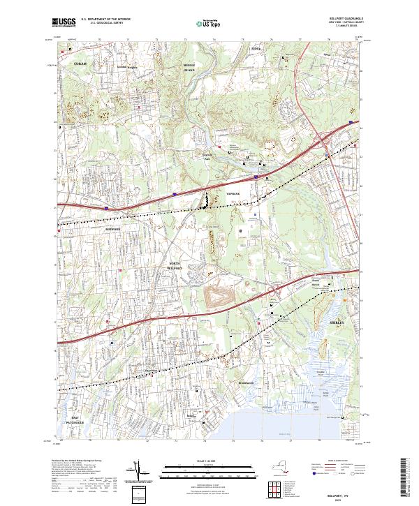
2023 Map of Bellport
USGS Topo · Published 2023About this map
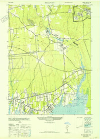
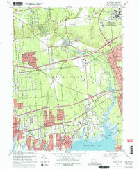
The Carmans River corridor serves as the central artery for this Long Island landscape, connecting the interior ponds at Yaphank to the coastal marshes of Bellport Bay. This modern survey details a complex web of historic burial grounds and family plots that mark the early settlement of Suffolk County. Genealogists can locate several small, family-named sites such as the Nathaniel Hawkins Cem and the Samuel Carman and Nathaniel Miller Cem near South Haven. The map reveals the persistent geography of the Long Island railroad line and the Montauk Hwy, which parallel the coast through established communities like East Patchogue and Shirley. Further inland, the transition from residential clusters in Medford and Coram to the open tracts around Upton illustrates the varied land use of the central island. Historic religious sites, including the Yaphank Presbyterian Church, remain anchored in the village centers.
Find a feature on this map
75 named features on this map. Tap any name to fly to it.
Don’t see what you’re looking for? This feature index may not catch every label — zoom into the map to look around manually.
Map Details
Editions of this 2023 Bellport Map
This is the sole edition of this map. No revisions or reprints were ever made.
Historical Maps of Middle Island Through Time
4 maps found