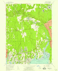
1956 Map of Bellport
USGS Topo · Published 1958About this map
Carmans River flows south toward Bellport Bay, anchoring a mid-century landscape of South Shore hamlets and scientific expansion. The northern reaches are dominated by the U S Reservation Brookhaven National Laboratory, while the rail corridor of the Long Island Railroad connects established centers like Yaphank and Medford Station. Local infrastructure is well-defined, ranging from the Brookhaven Memorial Hospital to the Suffolk Home.
Find a feature on this map
83 named features on this map. Tap any name to fly to it.
Don’t see what you’re looking for? This feature index may not catch every label — zoom into the map to look around manually.
Map Details
Editions of this 1956 Bellport Map
This is the sole edition of this map. No revisions or reprints were ever made.
Other maps of this area

1902 · Setauket
USGS Topo · 1:62,500

1902 · Fire Island
USGS Topo · 1:62,500

1903 · Fire Island
USGS Topo · 1:62,500

1904 · Setauket
USGS Topo · 1:62,500

1904 · Islip
USGS Topo · 1:125,000

1904 · Moriches
USGS Topo · 1:62,500

1919 · Setauket
USGS Topo · 1:62,500

1942 · Islip
USGS Topo · 1:125,000

1947 · Bellport
USGS Topo · 1:24,000

1947 · Howells Point
USGS Topo · 1:24,000