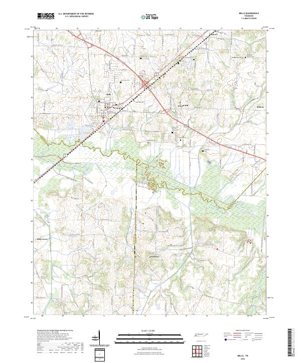
2022 Map of Bells
USGS Topo · Published 2022About this map
The town of Bells sits at a critical junction of Crockett County, where multiple regional roads and rail lines historically converged. The surrounding landscape is defined by the wide bottomlands of the South Fork Forked Deer River, which forms a complex system of wetlands and tributaries like Pearsons Cr and Conley Cr. This map documents a deeply rooted rural community, evidenced by the high density of family and community cemeteries such as Belleview Cem, Nathaniel Williams Cem, and Macedonia Cem that are scattered across the uplands. Small settlements like Fruitvale, Walnut Hill, and Providence dot the territory, connected by a network of local routes including Neil Warren Rd and Jerusalem Rd. The transition from the elevated plains near Holly Grove to the river valley illustrates the area's agricultural character, shaped by the persistent drainage patterns of Whitson Cr and Cypress Cr.
Find a feature on this map
101 named features on this map. Tap any name to fly to it.
Don’t see what you’re looking for? This feature index may not catch every label — zoom into the map to look around manually.
Map Details
Editions of this 2022 Bells Map
This is the sole edition of this map. No revisions or reprints were ever made.
Other maps of this area

1950 · Sunnyhill
USGS Topo · 1:24,000

1951 · Sunnyhill
USGS Topo · 1:24,000

1956 · Blytheville
USGS Topo · 1:250,000

1959 · Blytheville
USGS Topo · 1:250,000

1959 · Bells
USGS Topo · 1:24,000

1959 · Westover
USGS Topo · 1:24,000

1959 · Denmark
USGS Topo · 1:24,000

1959 · Adair
USGS Topo · 1:24,000

1959 · Humboldt
USGS Topo · 1:24,000

1961 · Jones
USGS Topo · 1:24,000