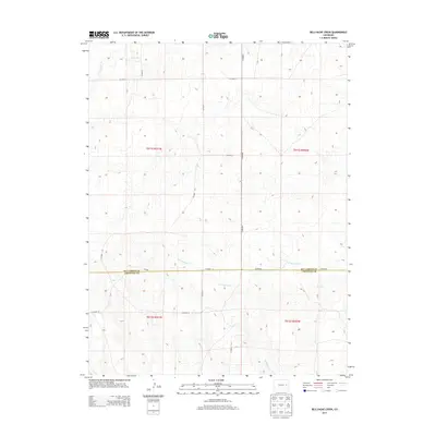
2013 Map of Bellyache Creek
USGS Topo · Published 2013About this map
Kit Carson Co Cheyenne Co marks the primary geographic divide across this high plains terrain, where the boundary between Kit Carson and Cheyenne counties follows the straight path of Co Road A. The landscape is defined by its drainage patterns, characterized by intermittent streams like Sand Cr in the north and the namesake Bellyache Cr in the southeast. A strictly organized section-line road network, including Co Road 6 and Co Road F, overlays the natural topography of the High Plains, illustrating the enduring influence of the Public Land Survey System. The presence of features like E Br Spring Cr and Pass Cr highlights the subtle relief and water-dependent geography of eastern Colorado’s ranching and agricultural country.
Find a feature on this map
18 named features on this map. Tap any name to fly to it.
Don’t see what you’re looking for? This feature index may not catch every label — zoom into the map to look around manually.
Map Details
Editions of this 2013 Bellyache Creek Map
This is the sole edition of this map. No revisions or reprints were ever made.
Other maps of this area

1891 · Arroyo
USGS Topo · 1:125,000

1891 · Kit Carson
USGS Topo · 1:125,000

1893 · Arroyo
USGS Topo · 1:125,000

1893 · Kit Carson
USGS Topo · 1:125,000

1954 · Limon
USGS Topo · 1:250,000

1954 · Lamar
USGS Topo · 1:250,000

1957 · Limon
USGS Topo · 1:250,000

1958 · Limon
USGS Topo · 1:250,000

1958 · Lamar
USGS Topo · 1:250,000

1978 · Sanders Ranch
USGS Topo · 1:24,000