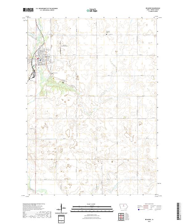
2022 Map of Belmond
USGS Topo · Published 2022About this map
Belmond stands at the confluence of the East Branch Iowa River and the West Branch Iowa River, where they merge to form the Iowa River. This survey illustrates a classic northern Iowa agricultural landscape organized by a strict township-and-range grid, yet softened by the winding courses of Luicks Cr and Ditch Number 146. The town's infrastructure is clearly defined, from the urban street grid of its residential core to the Belmond Municipal Airport on the northern outskirts. Genealogists and local historians can locate several burial grounds, including the Belmond Cem, Saint Francis Cem, and Immanuel Reformed Cem. The transition from old transit corridors to modern recreation is visible along the Franklin Grove Heritage Hiking and Biking Trl, which skirts the eastern edge of the community.
Find a feature on this map
41 named features on this map. Tap any name to fly to it.
Don’t see what you’re looking for? This feature index may not catch every label — zoom into the map to look around manually.
Map Details
Editions of this 2022 Belmond Map
This is the sole edition of this map. No revisions or reprints were ever made.
Other maps of this area

1954 · Waterloo
USGS Topo · 1:250,000

1955 · Waterloo
USGS Topo · 1:250,000

1972 · Cornelia
USGS Topo · 1:24,000

1972 · Alexander
USGS Topo · 1:24,000

1972 · Thornton
USGS Topo · 1:24,000

1972 · Olaf
USGS Topo · 1:24,000

1972 · Belmond
USGS Topo · 1:24,000
1972 · Goodell
USGS Topo · 1:24,000

1978 · Clarion
USGS Topo · 1:24,000

1978 · Dows West
USGS Topo · 1:24,000