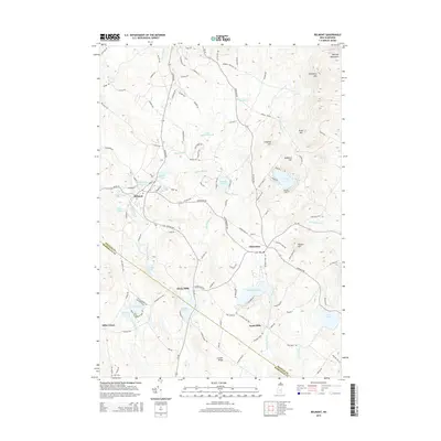
2015 Map of Belmont
USGS Topo · Published 2015About this map
Belmont serves as a primary hub in this New Hampshire landscape, situated at the confluence of the Tioga River and Pumping Station Br. The terrain is defined by a series of prominent elevations including Grant Hill, Lamprey Hill, and the foothills of the Belknap Mountains in the northeast corner. This 2015 update illustrates a region where water management and recreation are central, evidenced by the numerous named bodies of water such as Sawyer Lake, Sargent Lake, and the Tioga River Reservoir. Smaller settlements like Gilmanton, Allens Mills, and Jones Mills indicate the historical importance of local water power and agricultural clusters. Traces of early land use remain visible through features like the Ham Cem near the southern border and named routes like Shaker Rd and Fellows Hill Rd, which connect the scattered homesteads and small mill sites throughout the valley.
Find a feature on this map
116 named features on this map. Tap any name to fly to it.
Don’t see what you’re looking for? This feature index may not catch every label — zoom into the map to look around manually.
Map Details
Editions of this 2015 Belmont Map
This is the sole edition of this map. No revisions or reprints were ever made.
Other maps of this area

1909 · Winnepesaukee
USGS Topo · 1:62,500

1919 · Gilmanton
USGS Topo · 1:62,500

1925 · Holderness
USGS Topo · 1:62,500

1927 · Penacook
USGS Topo · 1:62,500

1927 · Gilmanton
USGS Topo · 1:62,500

1927 · Holderness
USGS Topo · 1:62,500

1949 · Portland
USGS Topo · 1:250,000

1956 · Winnipesaukee
USGS Topo · 1:62,500

1956 · Penacook
USGS Topo · 1:62,500

1956 · Holderness
USGS Topo · 1:62,500