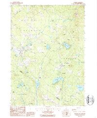
1987 Map of Belmont
USGS Topo · Published 1987About this map
The town of Belmont serves as the focal point for this late-twentieth-century study of the Belknap County interior. The landscape is defined by its transition from water-powered industry to managed conservation, evidenced by the numerous state lands including Sanborn State Forest and Meadow Pond State Forest. Small nineteenth-century industrial footprints are still visible at Aliens Mills and Jones Mills, where the local stream network once supported regional mill activity.
Find a feature on this map
46 named features on this map. Tap any name to fly to it.
Don’t see what you’re looking for? This feature index may not catch every label — zoom into the map to look around manually.
Map Details
Editions of this 1987 Belmont Map
This is the sole edition of this map. No revisions or reprints were ever made.
Other maps of this area

1909 · Winnepesaukee
USGS Topo · 1:62,500

1919 · Gilmanton
USGS Topo · 1:62,500

1925 · Holderness
USGS Topo · 1:62,500

1927 · Penacook
USGS Topo · 1:62,500

1927 · Gilmanton
USGS Topo · 1:62,500

1927 · Holderness
USGS Topo · 1:62,500

1949 · Portland
USGS Topo · 1:250,000

1956 · Winnipesaukee
USGS Topo · 1:62,500

1956 · Penacook
USGS Topo · 1:62,500

1956 · Holderness
USGS Topo · 1:62,500