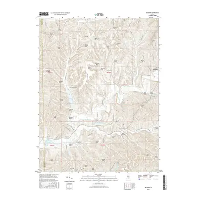
2016 Map of Belmont
USGS Topo · Published 2016About this map
Nashville and the surrounding township of Brown County center this 2016 survey, a landscape defined by an intricate network of ridges and hollows. The terrain is marked by numerous family-named landmarks like Watton Hill, Lee Brown Ridge, and Bill Jack Ridge, reflecting the deep-rooted local history of this region. North Fork Salt Creek and its tributaries, including Lower Schooner Cr and Green Valley Cr, carve through the topography, feeding into significant water bodies such as Yellowwood Lake and Somerset Lake.
Find a feature on this map
125 named features on this map. Tap any name to fly to it.
Don’t see what you’re looking for? This feature index may not catch every label — zoom into the map to look around manually.
Map Details
Editions of this 2016 Belmont Map
This is the sole edition of this map. No revisions or reprints were ever made.
Other maps of this area

1942 · Franklin
USGS Topo · 1:125,000

1946 · Belmont
USGS Topo · 1:24,000

1947 · Allens Creek
USGS Topo · 1:24,000

1947 · Unionville
USGS Topo · 1:24,000

1947 · Nashville
USGS Topo · 1:24,000

1947 · Elkinsville
USGS Topo · 1:24,000

1947 · Franklin
USGS Topo · 1:62,500

1948 · Hindustan
USGS Topo · 1:24,000

1948 · Fruitdale
USGS Topo · 1:24,000

1948 · Morgantown
USGS Topo · 1:24,000