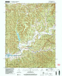
1998 Map of Belmont
USGS Topo · Published 2003About this map
Yellowwood State Forest dominates the ridge-and-valley landscape of this central Indiana region, where the steep topography of Baughman Hill and Buckert Knob has historically constrained development to the narrow creek bottoms. The unincorporated community of Belmont and the western edge of Nashville serve as the primary human hubs, connected by a network of winding roads like Helmsburg Road. Cultural landmarks are scattered throughout the protected lands, including the TC Steele State Memorial and several rural worship centers such as Oak Grove Ch. The drainage patterns are defined by the Salt Creek system, which feeds into larger reservoirs like Yellowwood Lake and the eastern reaches of Monroe Lake. The map reveals a transition from traditional rural life, evidenced by the West Tollhouse and Hickory Hill Cem, toward modern recreation within Brown County State Park.
Find a feature on this map
54 named features on this map. Tap any name to fly to it.
Don’t see what you’re looking for? This feature index may not catch every label — zoom into the map to look around manually.
Map Details
Editions of this 1998 Belmont Map
This is the sole edition of this map. No revisions or reprints were ever made.
Other maps of this area

1942 · Franklin
USGS Topo · 1:125,000

1946 · Belmont
USGS Topo · 1:24,000

1947 · Allens Creek
USGS Topo · 1:24,000

1947 · Unionville
USGS Topo · 1:24,000

1947 · Nashville
USGS Topo · 1:24,000

1947 · Elkinsville
USGS Topo · 1:24,000

1947 · Franklin
USGS Topo · 1:62,500

1948 · Hindustan
USGS Topo · 1:24,000

1948 · Fruitdale
USGS Topo · 1:24,000

1948 · Morgantown
USGS Topo · 1:24,000