2022 Map of Belmont
USGS Topo · Published 2022About this map
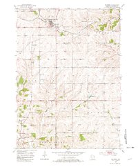
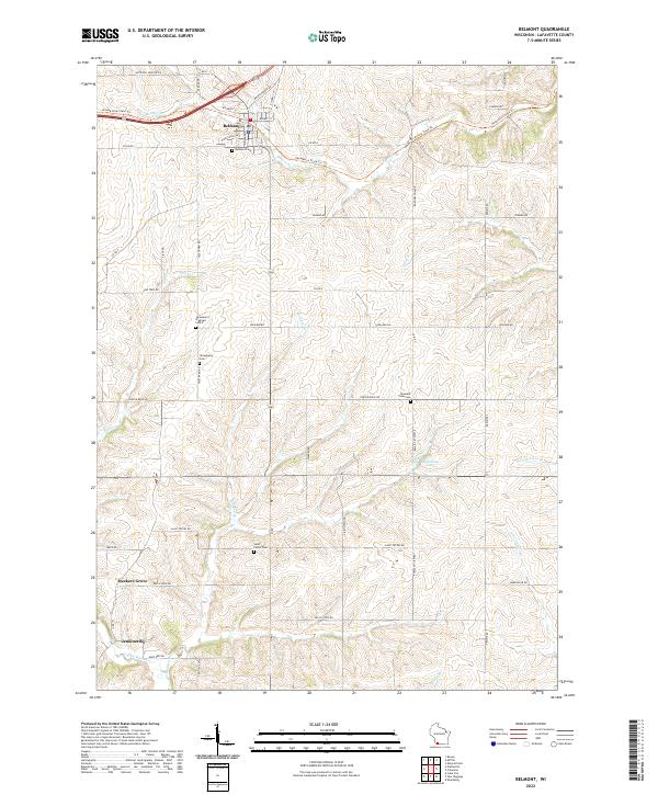
Belmont serves as the primary hub in this Lafayette County landscape, where the northern terrain is defined by the Pecatonica State Trl and the winding course of Bonner Br. The map reveals a high concentration of burial sites and historical markers, including the Belmont Cem, Strawberry Cem, Pleasant View Cem, and Saint Peters Cem, which suggest long-standing rural community ties. An industrial past is signaled by the Strawberry Diggings located near Strawberry Cem, pointing to the region's lead mining heritage. To the south, the settlements of Meekers Grove and Jenkinsville appear alongside the headwaters of the Galena River. The area's hydrology is complex, with numerous small waterways such as Pats Cr, Madden Br, and S Fork Ames Br cutting through the hills. This 2022 survey detail allows for the precise location of family-named landmarks like Beardsley Lake and various rural junctions along Saint Peters RD and Wardsville RD.
Find a feature on this map
55 named features on this map. Tap any name to fly to it.
Don’t see what you’re looking for? This feature index may not catch every label — zoom into the map to look around manually.
Map Details
Editions of this 2022 Belmont Map
This is the sole edition of this map. No revisions or reprints were ever made.