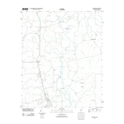
2012 Map of Belmont
USGS Topo · Published 2012About this map
Belmont serves as the primary hub in this corner of Tishomingo County, anchored by a street grid featuring Main St, Washington St, and Yarber St. The landscape to the north is defined by the winding course of Bear Creek, which is spanned by several critical crossings including Southward Bridge, Dennis Bridge, and Belmont Bridge. This waterway creates distinctive geographical features like Horseshoe Bend and Ten Island, while the surrounding terrain rises into the Freedom Hills and Chinquapin Ridge.
Find a feature on this map
145 named features on this map. Tap any name to fly to it.
Don’t see what you’re looking for? This feature index may not catch every label — zoom into the map to look around manually.
Map Details
Editions of this 2012 Belmont Map
This is the sole edition of this map. No revisions or reprints were ever made.
Other maps of this area

1935 · Holcut
USGS Topo · 1:24,000

1935 · Pleasant Site
USGS Topo · 1:24,000

1936 · Belmont
USGS Topo · 1:24,000

1936 · Red Bay
USGS Topo · 1:24,000

1936 · Halltown
USGS Topo · 1:24,000

1936 · Bishop
USGS Topo · 1:24,000

1936 · Tishomingo
USGS Topo · 1:24,000

1950 · Paden
USGS Topo · 1:24,000

1950 · Belmont
USGS Topo · 1:24,000
1950 · Bishop
USGS Topo · 1:24,000