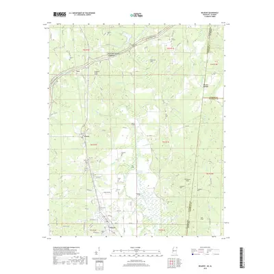
2018 Map of Belmont
USGS Topo · Published 2018About this map
Belmont serves as the primary hub in this corner of Tishomingo County, situated where the Tennessee Valley Divide separates the watershed. The landscape is defined by the winding course of Bear Creek and its associated Bear Creek Floodway, which passes under the Belmont Bridge. Smaller settlements like Dennis and Neil are connected by the historic route of the Natchez Trace Parkway, which cuts diagonally across the northern terrain near Horseshoe Bend.
Find a feature on this map
135 named features on this map. Tap any name to fly to it.
Don’t see what you’re looking for? This feature index may not catch every label — zoom into the map to look around manually.
Map Details
Editions of this 2018 Belmont Map
This is the sole edition of this map. No revisions or reprints were ever made.
Other maps of this area

1935 · Holcut
USGS Topo · 1:24,000

1935 · Pleasant Site
USGS Topo · 1:24,000

1936 · Belmont
USGS Topo · 1:24,000

1936 · Red Bay
USGS Topo · 1:24,000

1936 · Halltown
USGS Topo · 1:24,000

1936 · Bishop
USGS Topo · 1:24,000

1936 · Tishomingo
USGS Topo · 1:24,000

1950 · Paden
USGS Topo · 1:24,000

1950 · Belmont
USGS Topo · 1:24,000
1950 · Bishop
USGS Topo · 1:24,000