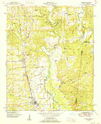
1951 Map of Belmont
USGS Topo · Published 1951About this map
The Tennessee Valley Divide snakes through this 1951 survey, separating the drainage systems in a landscape defined by the winding course of Bear Creek. The town of Belmont serves as the local hub along the Illinois Central railroad, which also connects the smaller settlements of Dennis and Neil. This era shows a community rooted in timber and agriculture, with numerous country churches such as Bethany Ch and Providence Ch serving as social anchors. A notable industrial presence is indicated by a Rock Quarry and a Gravel Pit, alongside several family-named landmarks like McNutt Branch and Joel Cem. The map captures the Mississippi-Alabama borderlands just as the State Park along the creek was being established, preserving the wooded bends and islands of the river valley before more modern development altered the rural character of Tishomingo County.
Find a feature on this map
60 named features on this map. Tap any name to fly to it.
Don’t see what you’re looking for? This feature index may not catch every label — zoom into the map to look around manually.
Map Details
Editions of this 1951 Belmont Map
This is the sole edition of this map. No revisions or reprints were ever made.
Other maps of this area

1935 · Holcut
USGS Topo · 1:24,000

1935 · Pleasant Site
USGS Topo · 1:24,000

1936 · Belmont
USGS Topo · 1:24,000

1936 · Red Bay
USGS Topo · 1:24,000

1936 · Halltown
USGS Topo · 1:24,000

1936 · Bishop
USGS Topo · 1:24,000

1936 · Tishomingo
USGS Topo · 1:24,000

1950 · Paden
USGS Topo · 1:24,000

1950 · Belmont
USGS Topo · 1:24,000
1950 · Bishop
USGS Topo · 1:24,000