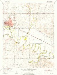
1953 Map of Beloit
USGS Topo · Published 1954About this map
The Solomon River meanders sharply through Mitchell County, anchoring the town of Beloit and the smaller community of Asherville during the early 1950s. This survey, conducted as part of the development of the Missouri River Basin, reveals a significant concentration of educational and civic institutions. In Beloit, the presence of the State Girls School and several local schools like Field Sch and Rodgers Sch point to its role as a regional center. The town's grid is dense with landmarks including the Courthouse, City Hall, and Chautauqua Park along the riverbanks.
Find a feature on this map
36 named features on this map. Tap any name to fly to it.
Don’t see what you’re looking for? This feature index may not catch every label — zoom into the map to look around manually.
Map Details
Editions of this 1953 Beloit Map
2 editions found
Other maps of this area

1892 · Concordia
USGS Topo · 1:125,000

1892 · Minneapolis
USGS Topo · 1:125,000

1894 · Mankato
USGS Topo · 1:125,000

1894 · Beloit
USGS Topo · 1:125,000

1952 · Glasco SW
USGS Topo · 1:24,000

1953 · Solomon Rapids
USGS Topo · 1:24,000

1953 · Simpson
USGS Topo · 1:24,000

1953 · Beloit
USGS Topo · 1:24,000

1955 · Manhattan
USGS Topo · 1:250,000

1955 · Beloit
USGS Topo · 1:250,000