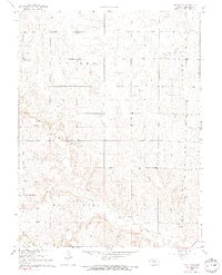
1968 Map of Beloit SW
USGS Topo · Published 1969About this map
The agrarian landscape of Mitchell County is defined here by the townships of Center, Bloomfield, and Round Springs. This 1968 field-checked survey reveals a rural network of farmsteads connected by section-line roads, with life centered around community landmarks like Pleasant View Ch and the Elmira Cem. The terrain is deeply etched by a series of waterways, including Leban Creek, Salt Creek, and Little Salt Creek, which create a complex drainage pattern across the central Kansas plains.
Find a feature on this map
12 named features on this map. Tap any name to fly to it.
Don’t see what you’re looking for? This feature index may not catch every label — zoom into the map to look around manually.
Map Details
Editions of this 1968 Beloit SW Map
2 editions found
Other maps of this area

1894 · Beloit
USGS Topo · 1:125,000

1953 · Solomon Rapids
USGS Topo · 1:24,000

1953 · Glen Elder South
USGS Topo · 1:24,000

1953 · Beloit
USGS Topo · 1:24,000

1955 · Beloit
USGS Topo · 1:250,000

1959 · Beloit
USGS Topo · 1:250,000
1964 · Barnard
USGS Topo · 1:24,000
1964 · Beloit SE
USGS Topo · 1:24,000

1968 · Beloit SW
USGS Topo · 1:24,000

1968 · Lincoln NW
USGS Topo · 1:24,000