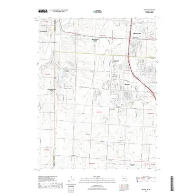
2017 Map of Belton
USGS Topo · Published 2017About this map
The Blue River and Little Blue River systems define the geography of this borderlands region, where the suburban expansion of Kansas City and Grandview meets the rolling landscapes of Cass County. This survey captures a moment of significant transition, showing the density of residential development in Belton and Loch Lloyd alongside more secluded rural pockets like Jaudon and the historic crossroads at Kenneth. Local history is preserved in traditional burial grounds such as Belton Cem and Bryant Cem, while the region's educational and logistical infrastructure is represented by the Calvary Bible Coll and Theological Seminary and local aviation hubs like Hillside Airport. The map's detail provides a clear view of how the modern road network has overlaid the original township sections, particularly where it crosses the state line into Leawood and Overland Park.
Find a feature on this map
140 named features on this map. Tap any name to fly to it.
Don’t see what you’re looking for? This feature index may not catch every label — zoom into the map to look around manually.
Map Details
Editions of this 2017 Belton Map
This is the sole edition of this map. No revisions or reprints were ever made.
Other maps of this area

1887 · Harrisonville
USGS Topo · 1:125,000

1887 · Olathe
USGS Topo · 1:125,000

1892 · Harrisonville
USGS Topo · 1:125,000

1893 · Olathe
USGS Topo · 1:125,000

1894 · Harrisonville
USGS Topo · 1:125,000

1934 · Grandview
USGS Topo · 1:24,000

1934 · Lees Summit
USGS Topo · 1:24,000

1935 · Lenexa
USGS Topo · 1:24,000

1939 · Grandview
USGS Topo · 1:31,680

1939 · Lees Summit
USGS Topo · 1:31,680