
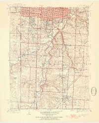
1934 Map of Grandview
USGS Topo · Published 1934About this map
Grandview and Martin City anchor this 1934 survey, revealing a landscape defined by the winding course of the Blue River and the convergence of major rail lines. The presence of the St Louis-San Francisco and Kansas City Southern railroads illustrates the area's importance as a transportation corridor between Missouri and Kansas. Cultural landmarks like Hickmans Mill and Hickmans Orchard point to the local agricultural roots that persisted even as suburban institutions like the Mission Hills Golf Club and Oakwood Golf Club began to appear.
Find a feature on this map
43 named features on this map. Tap any name to fly to it.
Don’t see what you’re looking for? This feature index may not catch every label — zoom into the map to look around manually.
Map Details
Editions of this 1934 Grandview Map
3 editions found

Other maps of this area

1887 · Harrisonville
USGS Topo · 1:125,000

1887 · Olathe
USGS Topo · 1:125,000

1890 · Kansas City
USGS Topo · 1:125,000

1892 · Harrisonville
USGS Topo · 1:125,000

1893 · Olathe
USGS Topo · 1:125,000

1894 · Kansas City
USGS Topo · 1:125,000

1894 · Harrisonville
USGS Topo · 1:125,000

1894 · Independence
USGS Topo · 1:125,000

1934 · Independence
USGS Topo · 1:24,000

1934 · Lees Summit
USGS Topo · 1:24,000