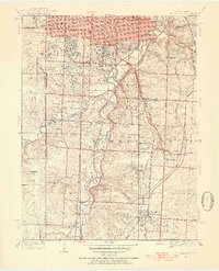
1934 Map of Grandview
USGS Topo · Published 1954About this map
The Blue River valley south of Kansas City is mapped here in the mid-1930s, showing a landscape transitioning from suburban outskirts to rural townships. The settlement at Hickman Mills and the grid of Grandview anchor the eastern half of the map, while the western side is defined by the state line separating Kansas and Missouri. Transportation routes are heavily established, featuring the Kansas City Southern and St Louis-San Francisco railroads alongside burgeoning suburban developments like Indian Village.
Find a feature on this map
69 named features on this map. Tap any name to fly to it.
Don’t see what you’re looking for? This feature index may not catch every label — zoom into the map to look around manually.
Map Details
Editions of this 1934 Grandview Map
3 editions found

Other maps of this area

1887 · Harrisonville
USGS Topo · 1:125,000

1887 · Olathe
USGS Topo · 1:125,000

1890 · Kansas City
USGS Topo · 1:125,000

1892 · Harrisonville
USGS Topo · 1:125,000

1893 · Olathe
USGS Topo · 1:125,000

1894 · Kansas City
USGS Topo · 1:125,000

1894 · Harrisonville
USGS Topo · 1:125,000

1894 · Independence
USGS Topo · 1:125,000

1934 · Independence
USGS Topo · 1:24,000

1934 · Grandview
USGS Topo · 1:24,000