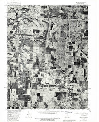
1980 Map of Belton
USGS Topo · Published 1981About this map
Richards-Gebaur Air Force Base dominates the northern half of this orthophotoquad, showing the massive runways and sprawling installation infrastructure at the turn of the 1980s. This aerial perspective, prepared by the United States Geological Survey in cooperation with the Soil Conservation Service, reveals a landscape in transition from the agricultural grid of Cass County to the expanding suburban footprints of Grandview and Belton. While the northern boundary is defined by the Little Blue River, the southern reaches remain primarily rural, dotted with the small settlement of Jaudon. The map overlays 1953 land lines onto 1980 imagery, providing a rare hybrid view of property boundaries and section lines against the actual visible development of communities like Belvidere during the Cold War era.
Find a feature on this map
12 named features on this map. Tap any name to fly to it.
Don’t see what you’re looking for? This feature index may not catch every label — zoom into the map to look around manually.
Map Details
Editions of this 1980 Belton Map
This is the sole edition of this map. No revisions or reprints were ever made.
Other maps of this area

1887 · Harrisonville
USGS Topo · 1:125,000

1887 · Olathe
USGS Topo · 1:125,000

1892 · Harrisonville
USGS Topo · 1:125,000

1893 · Olathe
USGS Topo · 1:125,000

1894 · Harrisonville
USGS Topo · 1:125,000

1934 · Grandview
USGS Topo · 1:24,000

1934 · Lees Summit
USGS Topo · 1:24,000

1935 · Lenexa
USGS Topo · 1:24,000

1939 · Grandview
USGS Topo · 1:31,680

1939 · Lees Summit
USGS Topo · 1:31,680