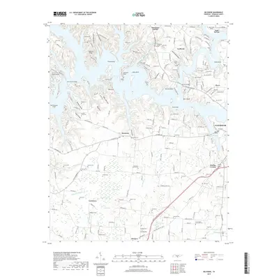
2019 Map of Belvidere
USGS Topo · Published 2019About this map
Tims Ford Lake dominates the northern reaches of this Tennessee landscape, its intricate shoreline creating numerous landforms such as Fanning Bend, Maple Bend, and Shasteen Bend. To the south, the terrain shifts into the fertile basins of Mingo Swamp and Mingo Pond. The map reveals a high density of small family and community burial grounds, including the Scivally-Green Cem, Pauper Cem, and Farris Chapel Community Cem, which provide significant genealogical data points for Franklin County families. Settlements like Belvidere, Broadview, and Winchester Springs are connected by a network of historic routes such as the Old David Crockett Hwy and Lynchburg Rd. In the northeast, the presence of the Myers-Smith Airport near Estill Springs contrasts with the many hollows and bluffs that define the rural character of the region.
Find a feature on this map
99 named features on this map. Tap any name to fly to it.
Don’t see what you’re looking for? This feature index may not catch every label — zoom into the map to look around manually.
Map Details
Editions of this 2019 Belvidere Map
This is the sole edition of this map. No revisions or reprints were ever made.
Other maps of this area

1928 · Decherd
USGS Topo · 1:62,500

1936 · Cumberland Springs
USGS Topo · 1:24,000

1936 · Beans Creek
USGS Topo · 1:24,000

1936 · Winchester
USGS Topo · 1:24,000

1936 · Huntland
USGS Topo · 1:24,000

1936 · Belvidere
USGS Topo · 1:24,000

1936 · Pitcher Ridge
USGS Topo · 1:24,000

1936 · Camp Peay
USGS Topo · 1:24,000

1936 · Capitol Hill
USGS Topo · 1:24,000

1936 · Lois
USGS Topo · 1:24,000