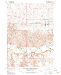
1951 Map of Belvidere
USGS Topo · Published 1979About this map
The Pine Ridge Indian Reservation occupies the southern half of this landscape, its northern border defined by the winding course of the White River. The terrain transitions from the river valley into the high plains where the settlement of Belvidere sits as a critical transport node. This location served as a vital link between the Chicago Milwaukee St Paul and Pacific railroad and the modern corridor of 90.
Find a feature on this map
12 named features on this map. Tap any name to fly to it.
Don’t see what you’re looking for? This feature index may not catch every label — zoom into the map to look around manually.
Map Details
Editions of this 1951 Belvidere Map
2 editions found
Other maps of this area

1951 · Pass Creek NW
USGS Topo · 1:24,000

1951 · Stamford SW
USGS Topo · 1:24,000

1951 · Belvidere
USGS Topo · 1:24,000

1951 · Belvidere SW
USGS Topo · 1:24,000

1951 · Cedar Butte NW
USGS Topo · 1:24,000

1951 · Pass Creek NE
USGS Topo · 1:24,000

1953 · Belvidere NE
USGS Topo · 1:24,000

1954 · Belvidere NW
USGS Topo · 1:24,000

1955 · Martin
USGS Topo · 1:250,000

1958 · Martin
USGS Topo · 1:250,000