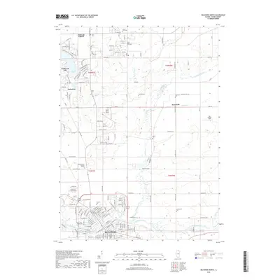
2018 Map of Belvidere North
USGS Topo · Published 2018About this map
Belvidere serves as the southern anchor of this 2018 survey, where the Kishwaukee River flows through the city's residential grid. Moving north, the landscape transitions from urban density to a more suburban and rural mix, dominated by planned communities like Candlewick Lake and Timberlane. The area is notably dense with burial grounds, including the Saint James Catholic Cem in town and more rural sites like Andrus Cem and Lawrenceville Cem, which offer significant touchpoints for genealogical research in Boone County.
Find a feature on this map
108 named features on this map. Tap any name to fly to it.
Don’t see what you’re looking for? This feature index may not catch every label — zoom into the map to look around manually.
Map Details
Editions of this 2018 Belvidere North Map
This is the sole edition of this map. No revisions or reprints were ever made.
Other maps of this area

1918 · Belvidere
USGS Topo · 1:62,500

1918 · Kirkland
USGS Topo · 1:62,500

1932 · Harvard
USGS Topo · 1:48,000

1937 · Harvard
USGS Topo · 1:62,500

1938 · Genoa
USGS Topo · 1:62,500

1944 · Belvidere
USGS Topo · 1:62,500

1954 · Rockford
USGS Topo · 1:250,000

1955 · Rockford
USGS Topo · 1:250,000

1958 · Rockford
USGS Topo · 1:250,000

1963 · Rockford
USGS Topo · 1:250,000