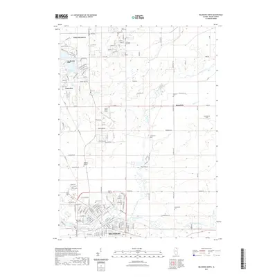
2021 Map of Belvidere North
USGS Topo · Published 2021About this map
Poplar Grove and the northern outskirts of Belvidere anchor this northern Illinois landscape, where residential development meets the agricultural plains of Boone County. The map captures a high density of small family and community burial grounds, including Clark Cem, Andrus Cem, and the South Poplar Grove Cem, which serve as vital markers for local genealogical research. To the west, the planned community surrounding Candlewick Lake shows a distinct suburban layout with streets like Lamplighter Loop SE and Candlewick Blvd SE contrasting with the traditional grid of the older townships. Waterways such as Piscasaw Creek and the Kishwaukee River meander through the terrain, while the Poplar Grove Airport and Bob Walberg Field highlight the area's modern infrastructure. The presence of Highland Garden of Memories and the Saint James Catholic Cem further emphasizes the deep-rooted community history concentrated along these drainage basins.
Find a feature on this map
147 named features on this map. Tap any name to fly to it.
Don’t see what you’re looking for? This feature index may not catch every label — zoom into the map to look around manually.
Map Details
Editions of this 2021 Belvidere North Map
This is the sole edition of this map. No revisions or reprints were ever made.
Other maps of this area

1918 · Belvidere
USGS Topo · 1:62,500

1918 · Kirkland
USGS Topo · 1:62,500

1932 · Harvard
USGS Topo · 1:48,000

1937 · Harvard
USGS Topo · 1:62,500

1938 · Genoa
USGS Topo · 1:62,500

1944 · Belvidere
USGS Topo · 1:62,500

1954 · Rockford
USGS Topo · 1:250,000

1955 · Rockford
USGS Topo · 1:250,000

1958 · Rockford
USGS Topo · 1:250,000

1963 · Rockford
USGS Topo · 1:250,000