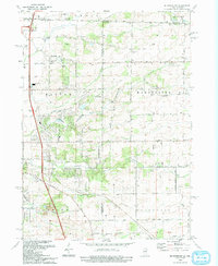
1993 Map of Belvidere NW
USGS Topo · Published 1993About this map
The border between Wisconsin and Illinois defines the northern edge of this 1993 study, where the rolling plains of Winnebago and Boone counties meet. This agricultural and suburbanizing landscape is carved by the winding paths of Kinnikinnick Creek and its southern branch, alongside major drainage from Turtle Creek in the north. The area is characterized by a high density of small rural burial grounds, including Pinnacle Hill, Forest Hill, Oak Hill, and Scotch cemeteries, suggesting a deeply rooted history of family farmsteads and early pioneer settlements.
Find a feature on this map
67 named features on this map. Tap any name to fly to it.
Don’t see what you’re looking for? This feature index may not catch every label — zoom into the map to look around manually.
Map Details
Editions of this 1993 Belvidere NW Map
This is the sole edition of this map. No revisions or reprints were ever made.
Other maps of this area

1891 · Janesville
USGS Topo · 1:62,500

1893 · Janesville
USGS Topo · 1:62,500

1893 · Shopiere
USGS Topo · 1:62,500

1918 · Rockford
USGS Topo · 1:62,500

1918 · Belvidere
USGS Topo · 1:62,500

1938 · Rockford
USGS Topo · 1:62,500

1944 · Belvidere
USGS Topo · 1:62,500

1949 · Rockford
USGS Topo · 1:24,000

1954 · Rockford
USGS Topo · 1:250,000

1955 · Rockford
USGS Topo · 1:250,000