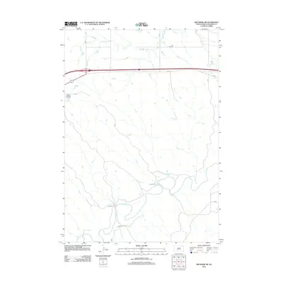
2012 Map of Belvidere SW
USGS Topo · Published 2012About this map
The White River winds through the southern reaches of this South Dakota landscape, carving a distinct path through the plains of Jackson County. In the early 21st century, this region remained characterized by a rural ranching economy, with named holdings such as Smith Ranch, Word Ranch, and Youman Ranch appearing as central local landmarks. The northern section of the terrain is defined by the east-west corridor of Interstate 90, running parallel to the older route of Hwy 16 and the Alt 90 highway alignment. Near the western edge, the Kadoka Municipal Airport serves as a small aviation hub for the surrounding community. Local history is anchored at the Flat Top Cem, which sits north of the intricate drainage patterns formed by Indian Cr and its tributaries as they flow toward the river valley.
Find a feature on this map
18 named features on this map. Tap any name to fly to it.
Don’t see what you’re looking for? This feature index may not catch every label — zoom into the map to look around manually.
Map Details
Editions of this 2012 Belvidere SW Map
This is the sole edition of this map. No revisions or reprints were ever made.
Other maps of this area

1951 · Pass Creek NW
USGS Topo · 1:24,000

1951 · Belvidere
USGS Topo · 1:24,000

1951 · Kadoka
USGS Topo · 1:24,000

1951 · Belvidere SW
USGS Topo · 1:24,000

1951 · Wanblee NE
USGS Topo · 1:24,000

1951 · Pass Creek NE
USGS Topo · 1:24,000

1953 · Belvidere NE
USGS Topo · 1:24,000

1954 · Belvidere NW
USGS Topo · 1:24,000

1954 · Kadoka NE
USGS Topo · 1:24,000

1955 · Martin
USGS Topo · 1:250,000