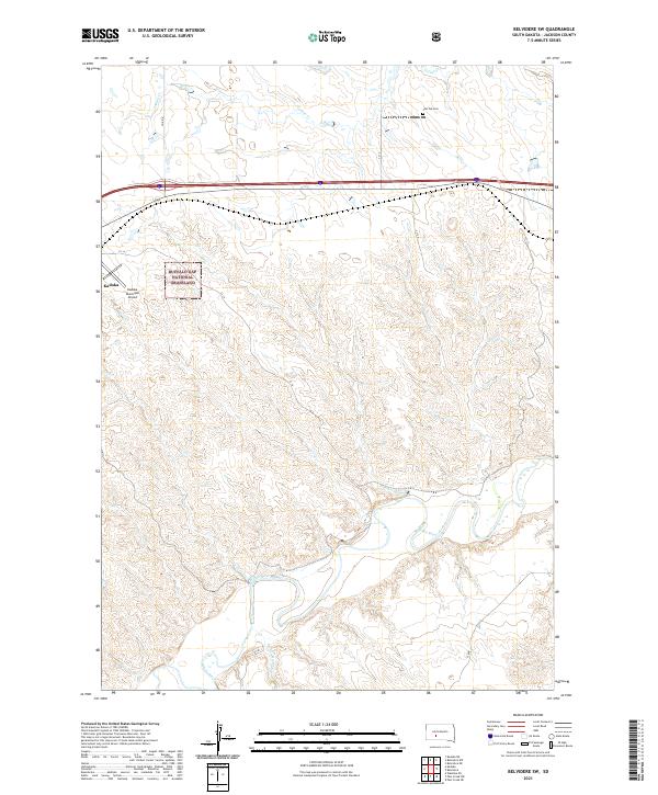
2021 Map of Belvidere SW
USGS Topo · Published 2021About this map
Buffalo Gap National Grassland dominates this portion of Jackson County, showcasing the vast open-range character of South Dakota's western plains. The meandering path of the White River carves through the southern section of the quadrangle, creating a distinct riparian corridor that contrasts with the surrounding dry uplands. Near the settlement of Kadoka, the Kadoka Municipal Airport serves as a local hub, while the presence of Flat Top Cem near Indian Cr provides a grounded point for genealogical research. The map captures a landscape defined by its section lines and watercourses, including Nancy Hanks Cr, reflecting the region's historical reliance on seasonal water for ranching and settlement. Transportation is marked by a network of county roads like Co RD 4 and various interior section-line tracks that bridge the gap between the prairie and the river valley.
Find a feature on this map
20 named features on this map. Tap any name to fly to it.
Don’t see what you’re looking for? This feature index may not catch every label — zoom into the map to look around manually.
Map Details
Editions of this 2021 Belvidere SW Map
This is the sole edition of this map. No revisions or reprints were ever made.
Other maps of this area

1951 · Pass Creek NW
USGS Topo · 1:24,000

1951 · Belvidere
USGS Topo · 1:24,000

1951 · Kadoka
USGS Topo · 1:24,000

1951 · Belvidere SW
USGS Topo · 1:24,000

1951 · Wanblee NE
USGS Topo · 1:24,000

1951 · Pass Creek NE
USGS Topo · 1:24,000

1953 · Belvidere NE
USGS Topo · 1:24,000

1954 · Belvidere NW
USGS Topo · 1:24,000

1954 · Kadoka NE
USGS Topo · 1:24,000

1955 · Martin
USGS Topo · 1:250,000