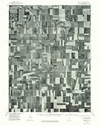
1975 Map of Bement NE
USGS Topo · Published 1977About this map
The village of Bement serves as the primary focal point of this 1975 orthophotoquad, showing the town's grid and surrounding agricultural landscape during the mid-1970s. This aerial perspective captures the intersection of local transportation routes and the residential core of the community, while the drainage of Lake Fork winds through the fields to the southeast. The map reveals the precise layout of Piatt County farmsteads and field boundaries as they existed nearly fifty years ago, providing an unvarnished look at the rural midwestern economy. Unlike traditional topographic maps, this photographic study records the exact density of woodlots and the specific footprints of individual farm buildings, making it a valuable tool for understanding the mid-century spatial development of the area.
Find a feature on this map
2 named features on this map. Tap any name to fly to it.
Don’t see what you’re looking for? This feature index may not catch every label — zoom into the map to look around manually.
Map Details
Editions of this 1975 Bement NE Map
This is the sole edition of this map. No revisions or reprints were ever made.
Other maps of this area

1907 · Mahomet
USGS Topo · 1:62,500

1937 · Monticello
USGS Topo · 1:48,000

1943 · Monticello
USGS Topo · 1:62,500

1950 · Tuscola
USGS Topo · 1:62,500

1955 · Bement
USGS Topo · 1:62,500

1957 · Mahomet
USGS Topo · 1:62,500

1958 · Peoria
USGS Topo · 1:250,000

1958 · Decatur
USGS Topo · 1:250,000

1961 · Peoria
USGS Topo · 1:250,000

1961 · Decatur
USGS Topo · 1:250,000