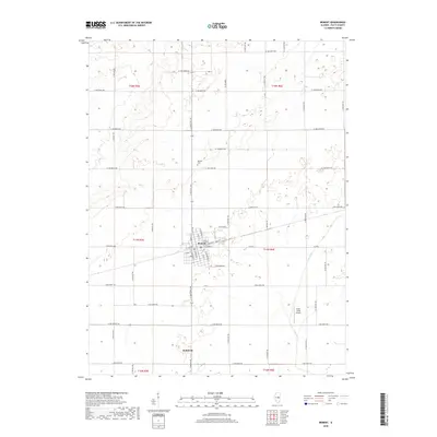
2018 Map of Bement
USGS Topo · Published 2018About this map
Bement serves as the primary hub of activity in this central Illinois landscape, showing a structured grid of streets intersected by the diagonal line of a major rail corridor. This transportation route, passing through the heart of the village near S State Rte 105, historically facilitated the movement of grain and goods across the prairie. Outside the town limits, the terrain is defined by an extensive network of rural roads such as E 1100 North Rd and N 1000 East Rd, which segment the land into productive agricultural blocks typical of the region's development.
Find a feature on this map
55 named features on this map. Tap any name to fly to it.
Don’t see what you’re looking for? This feature index may not catch every label — zoom into the map to look around manually.
Map Details
Editions of this 2018 Bement Map
This is the sole edition of this map. No revisions or reprints were ever made.
Other maps of this area

1907 · Mahomet
USGS Topo · 1:62,500

1937 · Monticello
USGS Topo · 1:48,000

1943 · Monticello
USGS Topo · 1:62,500

1950 · Tuscola
USGS Topo · 1:62,500

1955 · Bement
USGS Topo · 1:62,500

1957 · Mahomet
USGS Topo · 1:62,500

1958 · Peoria
USGS Topo · 1:250,000

1958 · Decatur
USGS Topo · 1:250,000

1961 · Peoria
USGS Topo · 1:250,000

1961 · Decatur
USGS Topo · 1:250,000