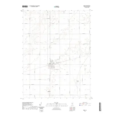
2021 Map of Bement
USGS Topo · Published 2021About this map
Bement serves as the primary hub of this Piatt County landscape, where a dense grid of residential streets like N Champaign St and E Bodman St meet at the town center. The settlement is anchored by the presence of Bement Cem to the north and the nearby crossing of S State Rte 105, which bisects the agricultural grid. To the south, the small community of Bodmann sits at the intersection of rural routes, reflecting the dispersed nature of central Illinois farm settlements.
Find a feature on this map
47 named features on this map. Tap any name to fly to it.
Don’t see what you’re looking for? This feature index may not catch every label — zoom into the map to look around manually.
Map Details
Editions of this 2021 Bement Map
This is the sole edition of this map. No revisions or reprints were ever made.
Other maps of this area

1907 · Mahomet
USGS Topo · 1:62,500

1937 · Monticello
USGS Topo · 1:48,000

1943 · Monticello
USGS Topo · 1:62,500

1950 · Tuscola
USGS Topo · 1:62,500

1955 · Bement
USGS Topo · 1:62,500

1957 · Mahomet
USGS Topo · 1:62,500

1958 · Peoria
USGS Topo · 1:250,000

1958 · Decatur
USGS Topo · 1:250,000

1961 · Peoria
USGS Topo · 1:250,000

1961 · Decatur
USGS Topo · 1:250,000