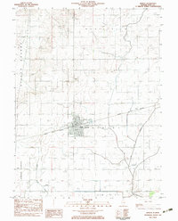
1983 Map of Bement
USGS Topo · Published 1983About this map
The village of Bement serves as the central hub of this central Illinois landscape, where the Norfolk and Western railway corridor dictates the layout of the town and surrounding farmland. As a 1983 provisional survey, the map captures the community’s infrastructure including the High Sch, the Bement Cem, and a dedicated Forest Preserve on the village's eastern edge. The surrounding terrain is defined by engineered water management and aviation, with the Hammond Mutual Ditch and Lake Fork draining the agricultural flats while private aviation facilities like the Bartram Landing Strip and Triple Creek Landing Strip appear in the southern sections. This survey documents the transition of the Illinois prairie into a highly organized grid of township boundaries and transportation routes during the late twentieth century.
Find a feature on this map
17 named features on this map. Tap any name to fly to it.
Don’t see what you’re looking for? This feature index may not catch every label — zoom into the map to look around manually.
Map Details
Editions of this 1983 Bement Map
This is the sole edition of this map. No revisions or reprints were ever made.
Other maps of this area

1907 · Mahomet
USGS Topo · 1:62,500

1937 · Monticello
USGS Topo · 1:48,000

1943 · Monticello
USGS Topo · 1:62,500

1950 · Tuscola
USGS Topo · 1:62,500

1955 · Bement
USGS Topo · 1:62,500

1957 · Mahomet
USGS Topo · 1:62,500

1958 · Peoria
USGS Topo · 1:250,000

1958 · Decatur
USGS Topo · 1:250,000

1961 · Peoria
USGS Topo · 1:250,000

1961 · Decatur
USGS Topo · 1:250,000