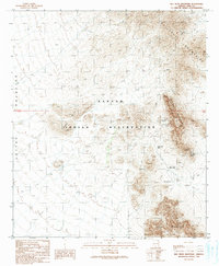
1990 Map of Ben Nevis Mountain
USGS Topo · Published 1990About this map
Papago Indian Reservation territory is meticulously detailed in this 1990 provisional study, centered on the mineral-rich elevations of the Quijotoa Mountains. The landscape is dominated by mining history, with numerous excavations such as the Quijotoa Mine, Weldon Mine, and Ben Lomond Mines concentrated along the slopes of Ben Nevis Mountain. These sites, along with various mine shafts and prospects, indicate a region defined by its geological extraction efforts during the late 20th century.
Find a feature on this map
21 named features on this map. Tap any name to fly to it.
Don’t see what you’re looking for? This feature index may not catch every label — zoom into the map to look around manually.
Map Details
Editions of this 1990 Ben Nevis Mountain Map
This is the sole edition of this map. No revisions or reprints were ever made.
Other maps of this area

1953 · Ajo
USGS Topo · 1:250,000

1954 · Sonoyta
USGS Topo · 1:250,000

1957 · Ajo
USGS Topo · 1:250,000

1958 · Ajo
USGS Topo · 1:250,000

1962 · Ajo
USGS Topo · 1:250,000

1963 · Ajo
USGS Topo · 1:250,000

1963 · Kom Vo
USGS Topo · 1:62,500

1963 · Gu Oidak
USGS Topo · 1:62,500

1963 · Quijotoa Mts
USGS Topo · 1:62,500

1963 · Pisinimo
USGS Topo · 1:62,500