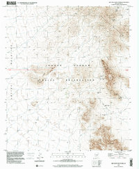
1996 Map of Ben Nevis Mountain
USGS Topo · Published 2001About this map
Quijotoa Mountains and the northern reaches of South Mountain define the desert landscape of this portion of the Tohono O'odham Indian Reservation. The terrain is marked by an extensive history of resource extraction, centered around Ben Nevis Mountain. Mining activity is recorded through numerous Mine Shafts, Adits, and specific operations such as the Quijotoa Mine and Weldon Mine. Near the center of the range, Ben Lomond Mines sits tucked within the high ridges.
Find a feature on this map
25 named features on this map. Tap any name to fly to it.
Don’t see what you’re looking for? This feature index may not catch every label — zoom into the map to look around manually.
Map Details
Editions of this 1996 Ben Nevis Mountain Map
This is the sole edition of this map. No revisions or reprints were ever made.
Other maps of this area

1953 · Ajo
USGS Topo · 1:250,000

1954 · Sonoyta
USGS Topo · 1:250,000

1957 · Ajo
USGS Topo · 1:250,000

1958 · Ajo
USGS Topo · 1:250,000

1962 · Ajo
USGS Topo · 1:250,000

1963 · Ajo
USGS Topo · 1:250,000

1963 · Kom Vo
USGS Topo · 1:62,500

1963 · Gu Oidak
USGS Topo · 1:62,500

1963 · Quijotoa Mts
USGS Topo · 1:62,500

1963 · Pisinimo
USGS Topo · 1:62,500