
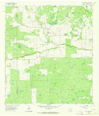
1956 Map of Benavides
USGS Topo · Published 1956About this map
The Texas Mexican R. R. serves as the central artery through this South Texas landscape, anchoring the town of Benavides and smaller outposts like Noleda. Surveyed originally by military engineers such as Frederick Herr in 1917, the map documents a transition from cattle ranching to industrial extraction. Local family heritage is deeply embedded in the land, reflected in numerous ranch names like Hoffman Ranch, Stein Ranch, and Santa Leona R.. Industrial development is concentrated near the tracks, where a Lime Quarry, a Shipping Corral, and clusters of oil wells suggest an economy shifting toward regional trade and natural resources. Beyond the settlement centers, the terrain is defined by drainages like Agua Poquita Creek and small rural communities including Guayilla and Flores.
Find a feature on this map
83 named features on this map. Tap any name to fly to it.
Don’t see what you’re looking for? This feature index may not catch every label — zoom into the map to look around manually.
Map Details
Editions of this 1956 Benavides Map
This is the sole edition of this map. No revisions or reprints were ever made.
Other maps of this area

1917 · Ben Bolt
USGS Topo · 1:62,500

1920 · San Diego
USGS Topo · 1:62,500

1921 · Falfurrias
USGS Topo · 1:125,000

1956 · Rosita Ranch
USGS Topo · 1:62,500

1956 · Freer
USGS Topo · 1:62,500

1956 · Laredo
USGS Topo · 1:250,000

1963 · San Diego
USGS Topo · 1:24,000

1963 · Ben Bolt NW
USGS Topo · 1:24,000
1963 · Palito Blanco
USGS Topo · 1:24,000
1963 · Seeligson Ranch
USGS Topo · 1:24,000