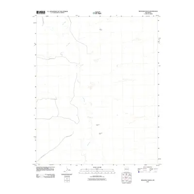
2010 Map of Benavidez Ranch
USGS Topo · Published 2010About this map
The Rio Puerco carves a winding path through this portion of New Mexico, defining a landscape of traditional ranching and indigenous lands. The map details the western edge of the Laguna Indian Res, where the Indian Service Rd serves as a primary artery across the desert terrain. Significant local holdings like the Benavidez Ranch and Rio Puerco Ranch anchor the area, reflecting the long-standing agricultural heritage of the region. Economic activity is further evidenced by the Heron Prospect, a small mining or mineral exploration site situated in the northern reaches of the quadrangle. This 2010 survey illustrates the continuity of these rural operations and the enduring geography of the river valley before more modern developments encroached from the east.
Find a feature on this map
6 named features on this map. Tap any name to fly to it.
Don’t see what you’re looking for? This feature index may not catch every label — zoom into the map to look around manually.
Map Details
Editions of this 2010 Benavidez Ranch Map
This is the sole edition of this map. No revisions or reprints were ever made.
Other maps of this area

1883 · Mt. Taylor
USGS Topo · 1:250,000

1886 · Mt. Taylor
USGS Topo · 1:250,000

1888 · Bernalillo
USGS Topo · 1:125,000

1889 · Albuquerque
USGS Topo · 1:125,000

1892 · Mt. Taylor
USGS Topo · 1:250,000

1893 · Albuquerque
USGS Topo · 1:125,000

1899 · Mt. Taylor
USGS Topo · 1:250,000

1954 · Herrera
USGS Topo · 1:24,000

1954 · Volcano Ranch
USGS Topo · 1:24,000

1954 · Sky Village
USGS Topo · 1:24,000