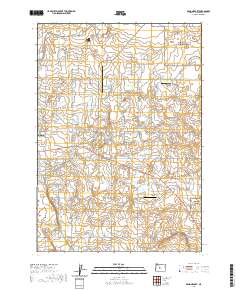
2020 Map of Bend Airport
USGS Topo · Published 2020About this map
Bend Municipal Airport anchors this landscape east of the growing city of Bend, illustrating the aviation and residential development of the High Desert. The terrain is characterized by a dense network of local roads and named family lanes like Abby Rd, Peterman Ln, and McGrath Rd, which trace the transition from ranching heritage to modern settlement. Aviation is a prominent theme, with Inspiration Airport and Kennel Airstrip serving as localized hubs alongside the larger municipal facility. Small hydrological features such as Mayfield Pond punctuate the landscape, while the grid of loop roads, including Pioneer Loop and Gentry Loop, shows how private land has been partitioned over time. This 2020 record captures the specific road layout and land use on the periphery of Deschutes County.
Find a feature on this map
90 named features on this map. Tap any name to fly to it.
Don’t see what you’re looking for? This feature index may not catch every label — zoom into the map to look around manually.
Map Details
Editions of this 2020 Bend Airport Map
This is the sole edition of this map. No revisions or reprints were ever made.
Other maps of this area

1926 · Bend
USGS Topo · 1:125,000

1929 · Bend
USGS Topo · 1:125,000

1931 · Newberry Crater
USGS Topo · 1:125,000

1935 · Newberry Crater
USGS Topo · 1:125,000

1955 · Crescent
USGS Topo · 1:250,000

1955 · Bend
USGS Topo · 1:250,000

1957 · Crescent
USGS Topo · 1:250,000

1957 · Bend
USGS Topo · 1:250,000

1958 · Crescent
USGS Topo · 1:250,000

1958 · Bend
USGS Topo · 1:250,000